

Birding Maps
Where to Go Bird Watching in Door County
Curious where exactly the best places are to spot your feathered friends? We've put together some of the top locations throughout the area to help you get started on your audubon adventure. Happy birding!

The Town Beach - Baileys Harbor
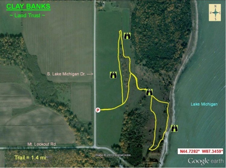
Clay Banks - Land Trust
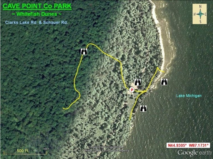
Cave Point Co. Park - Whitefish Dunes
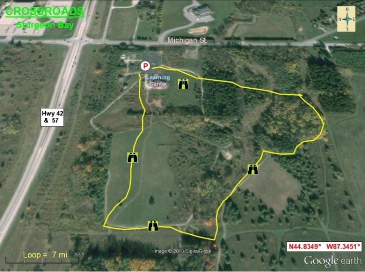
Sturgeon Bay Crossroads - Sturgeon Bay
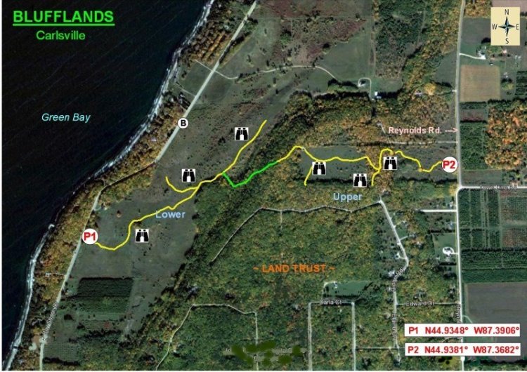
Blufflands - Carlsville
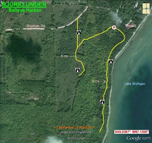
Bjorklunden - Baileys Harbor
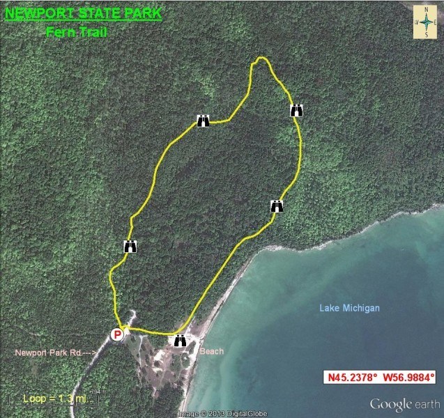
Newport State Park - Fern Trail
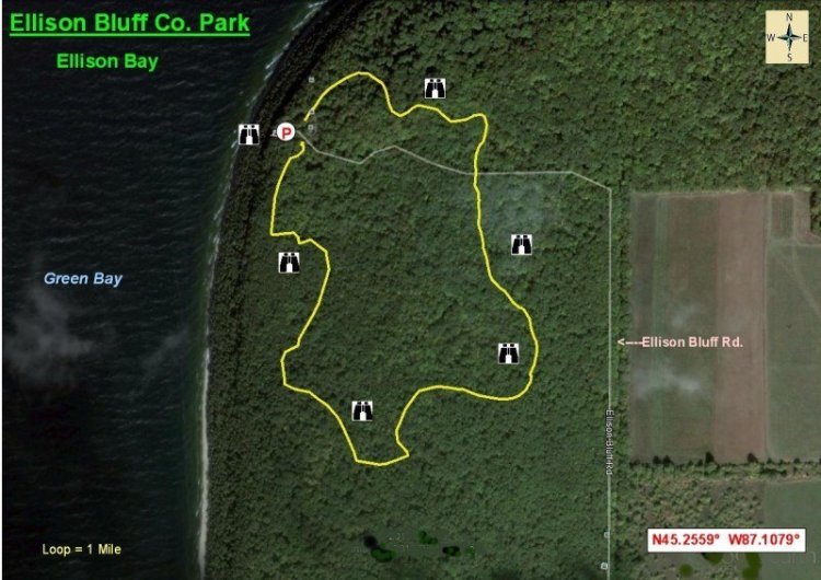
Ellison Bluff Co. Park - Ellison Bay

Fish Creek Park - Fish Creek
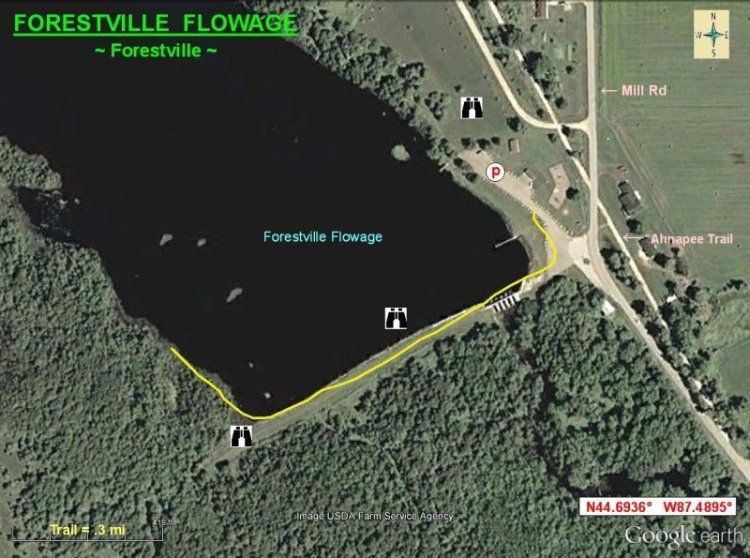
Forestville Flowage - Forestville
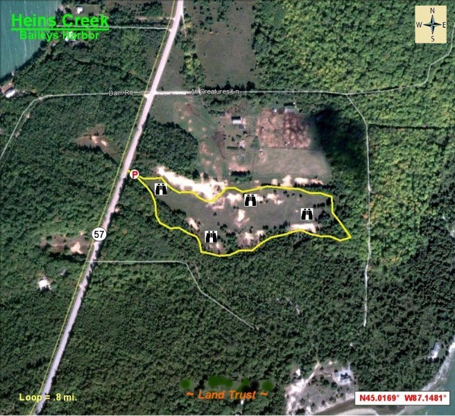
Heins Creek - Baileys Harbor
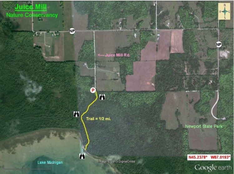
Juice Mill - Nature Conservancy
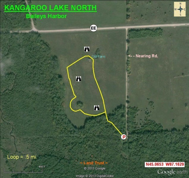
Kangaroo Lake North - Baileys Harbor
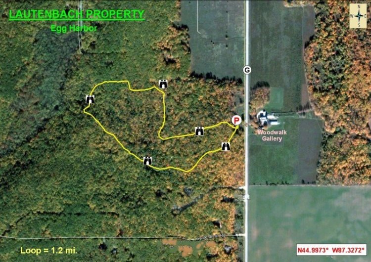
Lautenbach Property - Egg Harbor
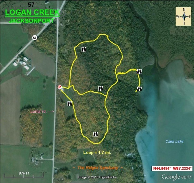
Logan Creek - Jacksonport
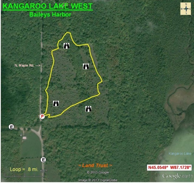
Kangaroo Lake West - Baileys Harbor
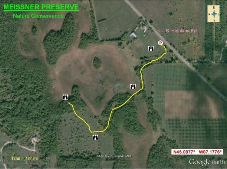
Meissner Preserve - Nature Conservance
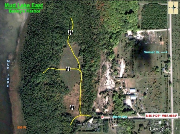
Mud Lake East - Baileys Harbor
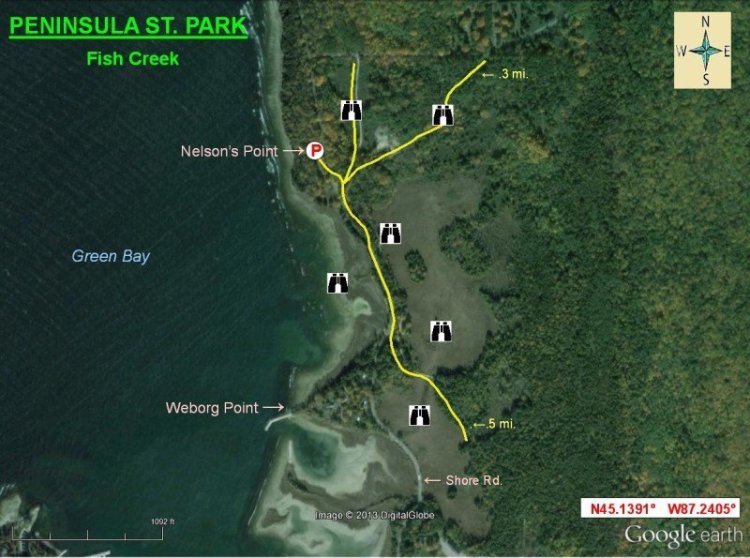
Nelson's Point (Peninsula State Park) - Fish Creek
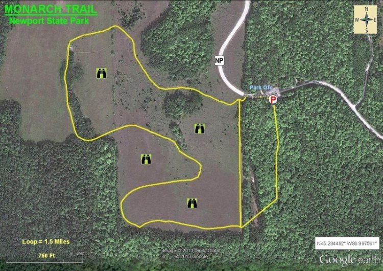
Monarch Trail - Newport State Park
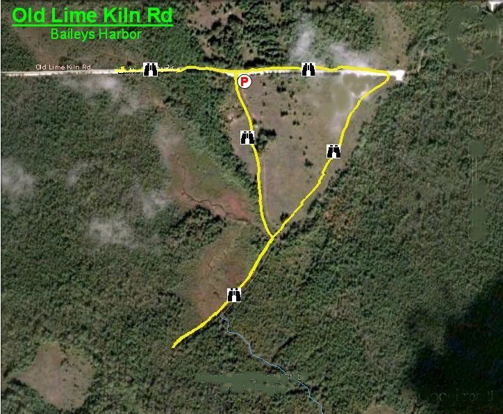
Old Lime Kiln Road - Baileys Harbor
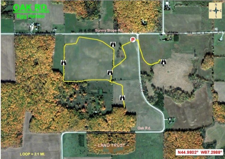
Oak Road - Egg Harbor
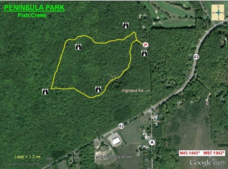
Peninsula Park - Fish Creek
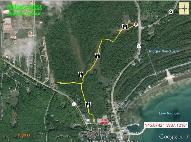
Ridges West - Baileys Harbor
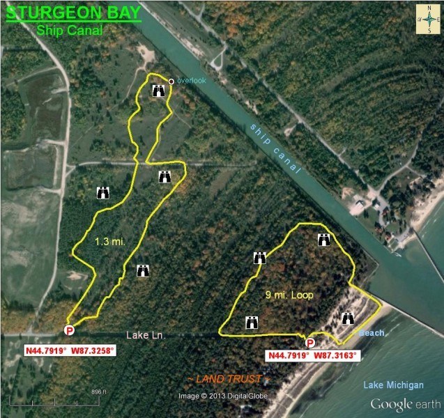
Ship Canal - Sturgeon Bay
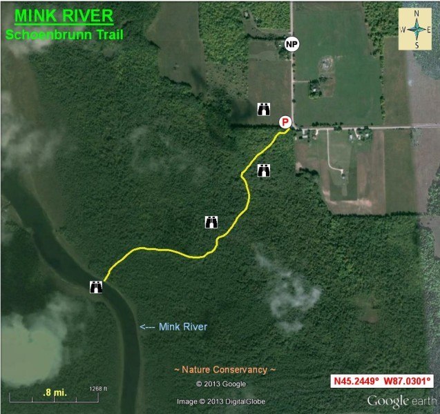
Mink River - Schoenbrunn Trail
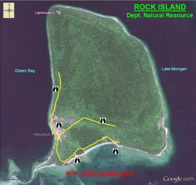
Rock Island - Dept. of Natural Resources
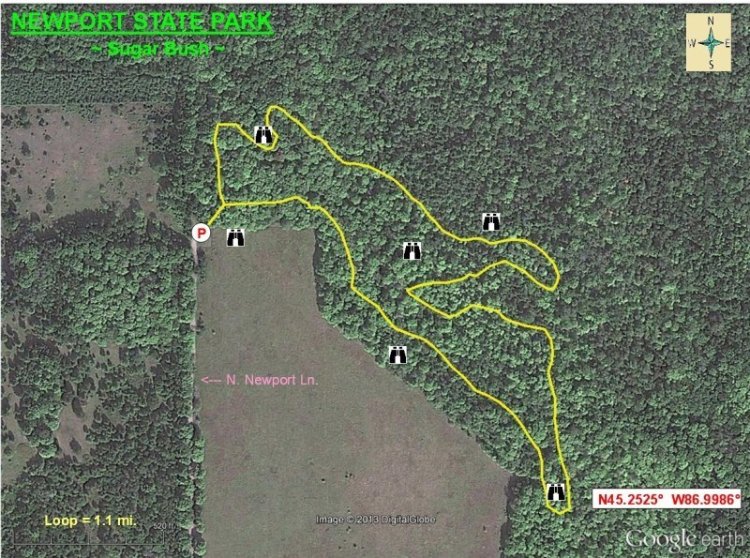
Newport State Park - Sugar Bush
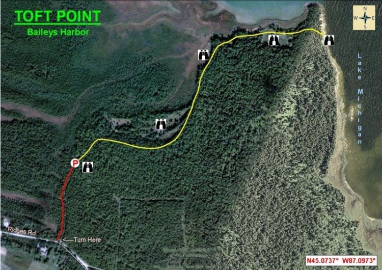
Toft Point - Baileys Harbor
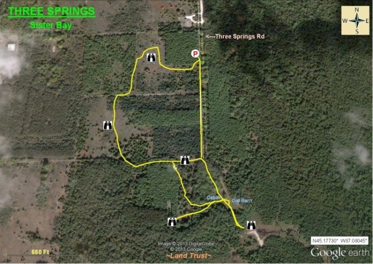
Three Springs - Sister Bay
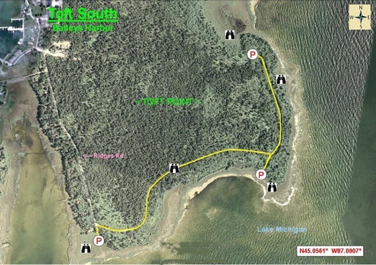
Toft South - Baileys Harbor
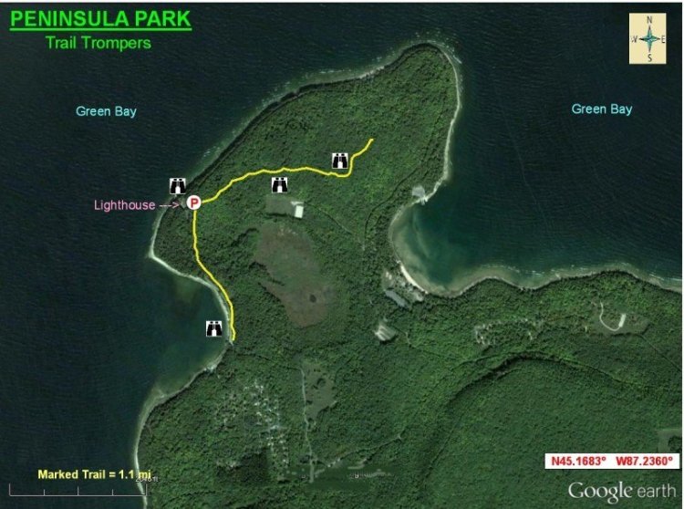
Trail Trompers - Peninsula Park
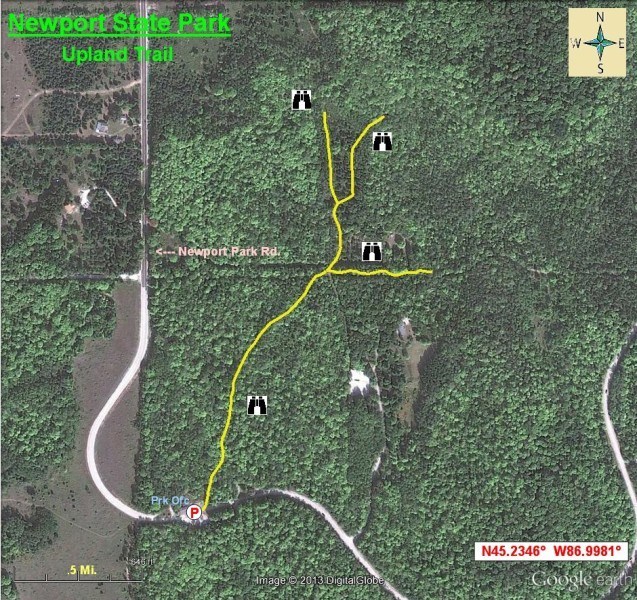
Upland Trail - Newport State Park
Discover Door County
Newsletter

Sign up for the monthly newsletter to get trip ideas, event announcements, and special offers.
Destination Guide
Order your free copy of the Official Door County Destination Guide and start planning your trip.